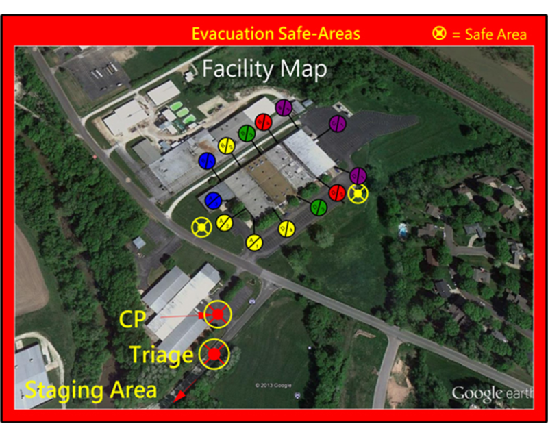
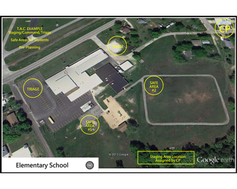
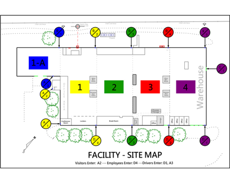
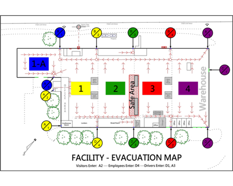
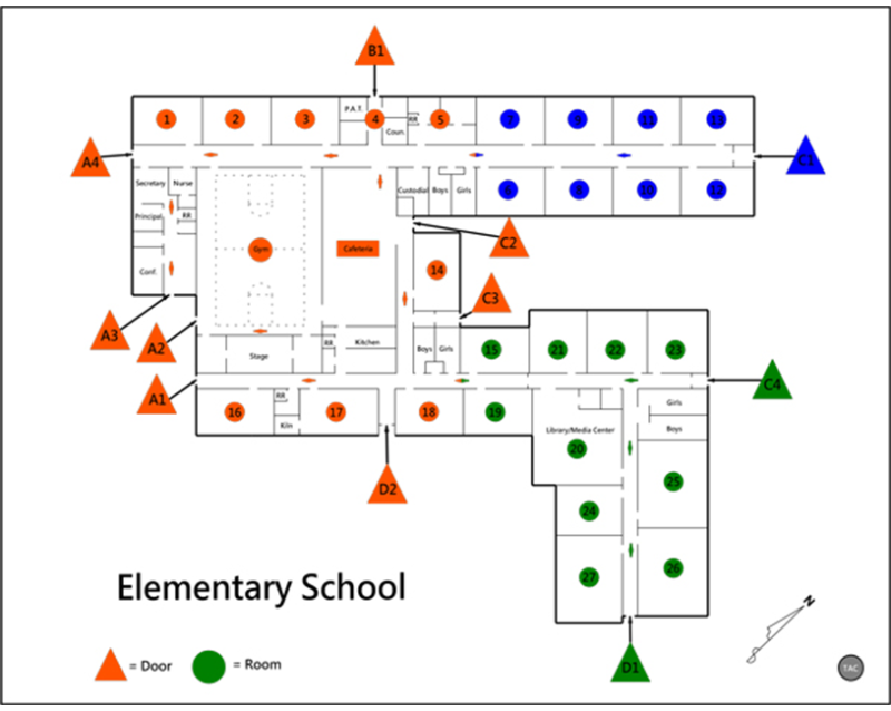
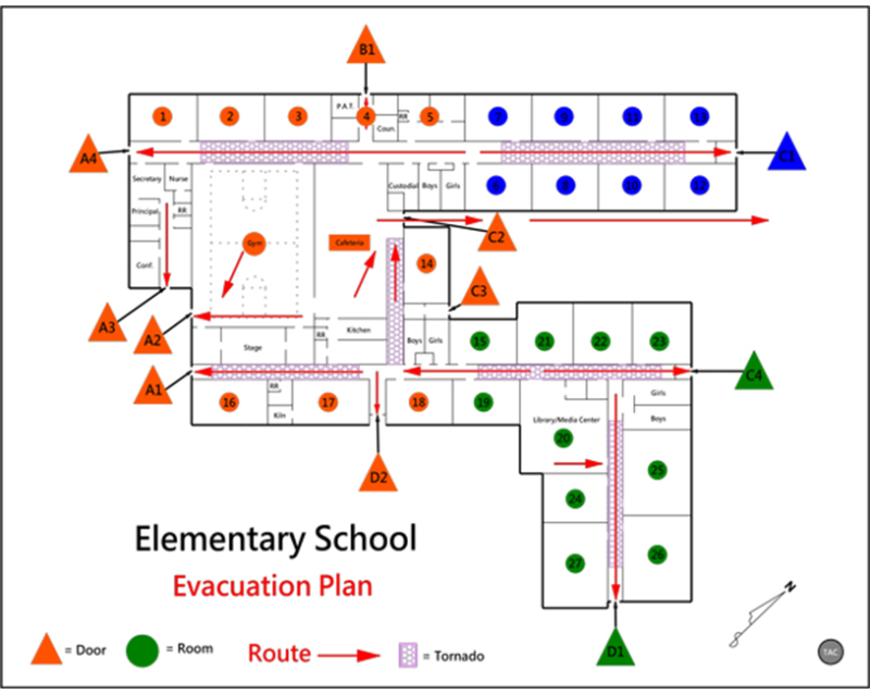
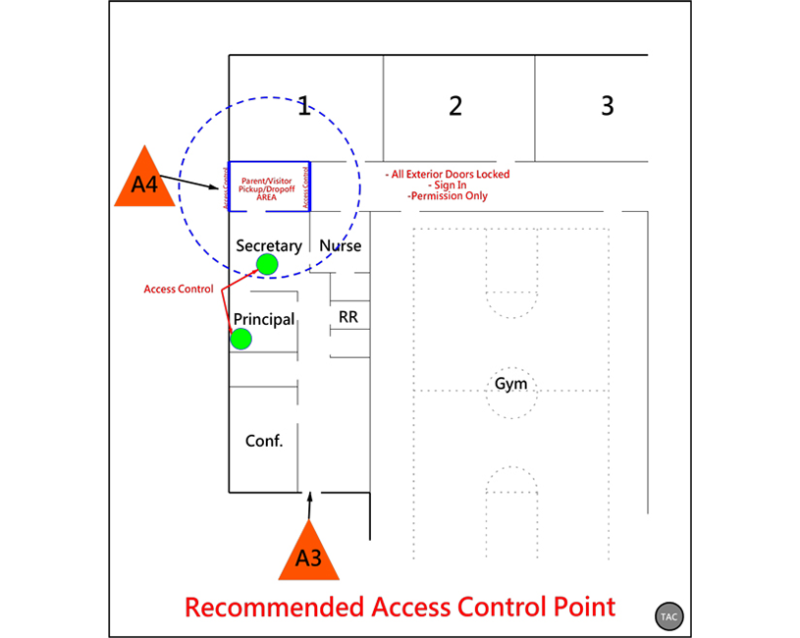
Crisis mapping is designed to be current with standards being established within the community and industry; while remaining consistent with the National Incident Management System protocols. This program is intended to improve efficiency for first responders as they work to locate and manage critical incidents. It is further designed to provide easy recognition for employees as they report the location of an emergency situation. Our crisis mapping system is electronically accessible to local first responders and can be used in a variety of critical situations from natural disasters to criminal activity.
It is proven in critical incident response that, time saves lives. By utilizing color coding and NIMS compliant facility numbering system, our mapping system is standardized, inclusive, and efficient. Most importantly, it is consistent for the first responders that are using the maps to reduce their time in response. Proper crisis mapping is an essential element to emergency response plans for schools, colleges, corporate, and public facilities. Efficient crisis mapping reduces liability and risk to the facilities, the population, and the first responders to any given emergency situation.
Our Services
Crisis Mapping


Contact Us
Copyright 2018 – TAC Security Consultants